
LiDAR Mapping for Comparing Detention Pond Locations Before Design
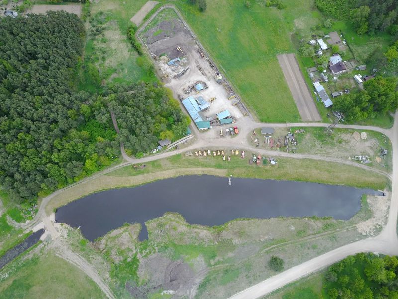
A detention pond can take up a big slice of a development site. Put it in the wrong spot, and you may lose prime lots, add extra grading, or end up with a pond that fights the natural flow of water. Those mistakes often surface late, after the site plan is already taking shape.
Developers who compare pond locations early tend to avoid that pain. LiDAR mapping gives you a fast, site-wide look at elevations and drainage before an engineer starts detailed design. With that data in hand, you can narrow your options to the spots that make sense and focus design money where it counts.
Why Detention Pond Location Matters in Early Site Planning
A detention pond is a basin that holds stormwater during heavy rain and releases it slowly. Its job is to keep runoff from your development from overwhelming downstream ditches, pipes, and neighbors. Many local stormwater rules require detention for new development, though the details vary by municipality, county, and project scope.
Location shapes how well the pond works and what it costs. Water needs to reach the pond by gravity, and the pond needs a way to drain to an approved outfall. A pond placed too high, too far from the outfall, or across natural flow lines may require deep pipes, large earthwork, or extra structures.
Location also affects how much land you can sell or build on. Every acre given to detention is an acre not used for lots, buildings, or parking. Choosing the spot early lets you design around it instead of squeezing it in later.
How LiDAR Mapping Identifies Potential Detention Pond Locations
LiDAR mapping uses laser pulses from a drone or aircraft to measure the ground in fine detail. The scanner records millions of points, and processing software turns them into a surface model of the site. That model shows high ground, low ground, and the paths water is likely to follow.
Good pond candidates usually stand out in that model. They tend to sit at natural low points where runoff already collects. They’re often near the place where water leaves the property today.
LiDAR also covers large sites quickly. Fields, pasture, brush, and partly wooded tracts can be mapped in a single flight. That makes it practical to study the whole property instead of guessing from a few spot elevations.
Comparing Ground Elevations and Drainage Areas Across Potential Sites
Once you have two or three possible locations, the next step is to compare them side by side. LiDAR elevation data makes that comparison much easier. You can measure how deep each spot sits, how steep the ground is around it, and how far it is from the outfall.
Drainage Areas
A drainage area is all the land that sends water toward a given point. Using the surface model, a surveyor or engineer can outline the drainage area for each candidate site. A spot that collects runoff from most of the developed area is often a stronger choice than one that catches only a corner.
Earthwork and Depth
Elevation data also helps estimate how much digging each location would need. A natural low spot may need less excavation than a site on higher ground. That early estimate can shift the cost picture in a meaningful way.
Evaluating Pond Locations Against Property Boundaries and Site Constraints
A good drainage spot still has to work on paper and in the field. Before you favor any location, check it against the legal and physical limits of the property. Many promising sites drop off the list at this stage.
Review these items for each candidate location:
- Property lines and any required setbacks from them
- Recorded easements for utilities, access, or drainage
- Floodplain mapping and any limits on fill or grading
- Existing utilities, pipelines, or overhead lines
- Wetlands, creeks, or protected areas that may need agency review
- Soil conditions and groundwater depth from geotechnical work
A boundary survey is the right tool for confirming lines and easements. LiDAR shows the ground, but it doesn’t set legal limits. Rules for setbacks, floodplain work, and environmental review can vary widely, so check with the local reviewing agency early.
Using LiDAR Data to Narrow Options Before Engineering Design
The real value of LiDAR at this stage is focus. Instead of paying an engineer to study every corner of the site, you hand them a short list of locations that already pass basic checks. That saves design time and keeps the early budget under control.
Share the LiDAR surface model, drainage area outlines, and boundary survey with your civil engineer. They can use that package to run early sizing and test how each option affects the site plan. From there, the team can pick a preferred location with good reasons behind it.
Once the location is chosen, detailed design usually needs more precise ground data. A topographic survey of the pond area, outfall, and nearby structures fills that gap. Confirm the survey scope early if permit submittal or construction dates depend on it.
Frequently Asked Questions
How does LiDAR mapping help identify suitable detention pond locations?
LiDAR mapping creates a detailed surface model of the whole site. That model shows natural low points and the paths runoff takes across the property. Spots where water already collects near the outfall often make strong pond candidates. Engineers can then compare those spots before detailed design begins.
Can LiDAR elevation data help compare drainage patterns across a development site?
Yes, it can. The elevation data lets a surveyor or engineer outline the drainage area for each possible pond location. You can see how much of the site drains toward each spot and how water moves between them. That makes side-by-side comparisons clearer and faster.
What site conditions should developers consider when selecting a detention pond location?
Start with elevation, drainage area, and the distance to an approved outfall. Then check soils, groundwater, floodplain limits, wetlands, and existing utilities. Each of these can affect cost, permitting, or how well the pond performs. Your engineer and local reviewers can tell you which factors matter most for your site.
Why are property boundaries and easements important when planning detention ponds?
A pond must fit inside your property and meet any required setbacks. Recorded easements may block grading or structures in certain areas. Placing a pond across a line or easement can cause permit delays or disputes. A boundary survey confirms those limits before design moves forward.
Can LiDAR mapping replace a detailed topographic survey for detention pond design?
Usually it can’t fully replace one. LiDAR works well for early planning and comparing locations across a large site. Final pond design often needs more precise elevations, structure details, and outfall data from field work. Most projects use LiDAR first and then add a topographic survey for the chosen location.